You can download directly from the links below. There is no other server or anything else to go through, so downloading should be very fast unless my server is down for any reason.
Table of Contents
Overview :: What maps should I download?
Maps are needed for certain campaigns. Typically you'll have to read the readme file included with a campaign to figure out which maps are needed. Not all of the maps are listed here yet - only the ones which interest me. I may add others too. For a more comprehensive list, please see Lasse Jensen's Builder's Paradise.
New Maps...
The original authors of the maps are SSI, William Dickens, Steve Brown, Leonid Usachov, Red Scorpion and Eric Peterson and many others. I will add their names as I get time.
| Map and Link | Author/Moderator | Uploaded | Misc. | Notes |
| Start... | ||||
|---|---|---|---|---|
| These maps are compatible with all versions of PG2. Please read the install directions. | ||||
| Installing Maps | Narayan Sengupta | These are the generic map installation instructions. | ||
| Steve Brown's PG2 Maps | Steve Brown | 02/12/03 | Steve has a great map section. He also gives some comments on each map he has created. He has posted maps of other authors. And he also has good thumbnail images too! Also a special thanks to Steve for allowing me to post his maps here for the entire community. | |
| Builder's Paradise MAP Section | Lasse Jensen | 02/12/03 | This site has ALL of the maps, as opposed to the limited selection I have. You can also see thumbnails of the various maps at Lasse's Builder's Paradise. | |
| Panzergeneral.net | Eric Peterson | 02/12/03 | Eric has a great map section. He also gives ratings and some comments on each map. | |
| Baltic General | Toliy | 02/12/03 | Don't let the "Baltic General" name fool you. Toliy has a comprehensive collection of PG2 maps (and icons and other goodies). | |
| All Maps (in alphabetical order) | ||||
| Just click directly on any of the links below to start downloading immediately. There should be no waiting time at all. The maps vary between 95 kb to 2 mb in size. | ||||
| Agedabia | Lasse Jensen | 02/12/03 | ||
| Aitape | Steve Brown | 02/12/03 | "Aitape is on the northern coast of New Guinea, east of my "Hollandia" and west of my "Madang" maps." - Steve Brown | |
| Alexandria | Lasse Jensen | 03/12/03 | ||
| Alamein | 04/01/03 | |||
| Algiers | Marco Infortugno | 02/12/03 | ||
| Anzac Cove | Doug Hone | 03/12/03 | ||
| Anzio | Leos | 02/12/03 | ||
| Arawe | Steve Brown | 02/12/03 | "This is the Arawe Peninsula on the south coast of New Britain, in New Guinea." - Steve Brown | |
| Ardennes | Ted Grospe | 02/12/03 | ||
| Arnhem | Stephen de Jong | 02/12/03 | ||
| Attu | Eric Myott | 02/12/03 | ||
| Auderville | Doug Hone | 03/17/03 | ||
| Avranches | Doug Hone | 03/17/03 | ||
| Baghdad | 03/12/03 | |||
| Balikpapan | 04/01/03 | |||
| Bastogne | Bjoern Neuhaeuser | 02/12/03 | ||
| Beirut | William Dickens | 03/12/03 | ||
| Belgrade | William Dickens | 02/12/03 | ||
| Benghazi | Marco Infortugno | 03/12/03 | ||
| Berlin | Andreas Seidel | 02/12/03 | ||
| Biak | Steve Brown | 02/12/03 | "This map is of part of Biak Island, which is off north coast of New Guinea (it is west of my Hollandia map). This map was the scene of a US operation in May-June 1944. This map has a lot of rough terrain, escarpments, fortifications (caves) and shallow sea and reefs (I use "river" for these)." - Steve Brown | |
| Borodino | Hannes Gruber | 03/12/03 | ||
| Bucharest | Doug Hone | 03/17/03 | ||
| Buin | Steve Brown | 03/12/03 | "This is a map of the area of the southern part of Empress Augusta Bay to Buin on the island of Bougainville, it is more-or-less south of my Torokina map." - Steve Brown | |
| Buka | Steve Brown | 03/12/03 | "This is a map of the northern part of Bougainville." - Steve Brown | |
| Bzura | 04/01/03 | |||
| Capebon | Lasse Jensen | 03/12/03 | ||
| Carentan | Doug Hone | 03/17/03 | ||
| Carpathia | 04/01/03 | |||
| Casablanca | Steve Brown | 03/12/03 | "This map is of the area around Casablanca. The map stretches from Casablanca in the southwest to Fedala in the northeast. Fedala is the location of "Operation Torch" landings in November, 1942." - Steve Brown | |
| Cassino | Bjoern Neuhaeuser | 02/12/03 | Also see Monte Cassino below. | |
| Cherbourg | Doug Hone | 03/12/03 | ||
| Chirval | 04/01/03 | |||
| Colmar | Doug Hone | 03/12/03 | "Colmar is north of Mulhouse and south of "Nordwind" - Steve Brown" | |
| Crete 2 | Christophe Mercier | 03/12/03 | ||
| Dieppe | Marco Infortugno | 02/12/03 | ||
| Don | 03/12/03 | |||
| Dover | Jens Cieslak | 02/12/03 | ||
| Dutch Harbor | 03/12/03 | |||
| Elba | Steve Brown | 03/17/03 | "This is the island of Elba, off the coast of Italy." - Steve Brown | |
| El Guettar | Steve Brown | 03/17/03 | "This map is of the El Guettar area in Tunisia. Compared to other PG2 maps is it south of "'Maknassy", southeast of "Kasserin" and some distance north of "Medenine". It was the scene of battles between French and Italian forces in late 1942 and US Army and Axis forces in March and April of 1943. The water at the east is not the coast - the "oceans" you see on the map are salt lakes." - Steve Brown | |
| England | Lasse Jensen | 02/12/03 | ||
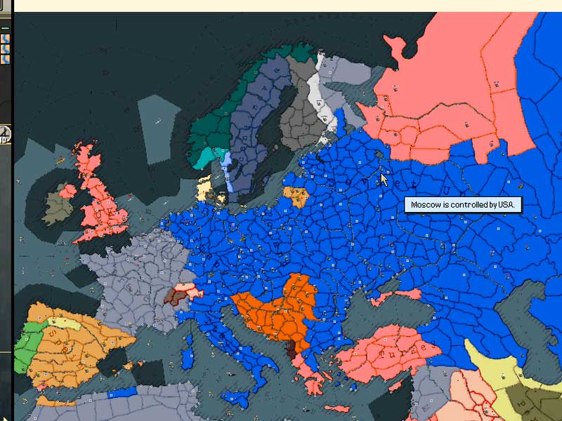
| Europe | Halberdier | 03/12/03 | This is a great map except that it lacks cities, ports and airfields. Can someone finish it up and then send it to me? | |
| Falklands East | Pablo Schlegel | 03/17/03 | ||
| Falklands West | Pablo Schlegel | 03/17/03 | ||
| Finschhafen | Steve Brown | 03/17/03 | "This is of the Finschhafen area of New Guinea, which is east of my Lae map." - Steve Brown | |
| Fondouk El Arab | Steve Brown | 03/17/03 | "This map is of the Fondouk el Aouareb area in Tunisia - usually known as the "Fondouk Gap". Compared to other PG2 maps is it north of "'Maknassy" and some distance south of "Tunis". It was the scene of battles between Allied and Axis forces from January to April of 1943." - Steve Brown | |
| Gambut | Barkmann | 03/17/03 | North Africa, near Tobruk | |
| Gazala | Paul Carlisle | 03/12/03 | ||
| Georgia | 03/12/03 | I think this is actually part of north of my home state of Georgia (in the USA). | ||
| Gibralter 2 | 02/12/03 | |||
| Golan | 04/01/03 | |||
| Gothic | Vito | 03/12/03 | ||
| Guadalcanal | Anton Geislitz | 02/12/03 | ||
| Halifax | 04/01/03 | |||
| Hollandia | Steve Brown | 03/17/03 | "Size - 845KB; Map number - 173. This map is of the Hollandia area on the north coast of New Guinea. This map was the scene of a US invasion in April 1944 but is also a good generic map for battles in the southwest Pacific theatre since it has a lot of the features of many of those battlefields" - Steve Brown | |
| Hong Kong | 02/12/03 | |||
| Iwo Jima 7 | Patrick Fitzgibbon | 02/12/03 | ||
| Kazan | SSI | 04/01/03 | ||
| Kasserine | Lasse Jensen | 03/12/03 | ||
| Kharkov | Vito | 02/12/03 | ||
| Kiev | William Dickens | 03/12/03 | ||
| Kokoda | Sneaky Pete | 03/17/03 | "Part of the Kokoda trail, in New Guinea" - Steve Brown | |
| Korinth | 04/01/03 | |||
| Kufra | Steve Brown | 03/17/03 | "Size - 1,319KB; Map number - 161. This is of Kufra in southern Libya (it is a few hundred kilometres almost directly south of Tobruk). Free French and Italian forces fought here in early 1941, plus it is also a good generic desert map. There is not much on this map - it's desert." - Steve Brown | |
| Kursk | Waldemar Irrek | 03/12/03 | ||
| Lae | Steve Brown | 03/17/03 | "Size - 967KB; Map number - 177. This map is of the Lae, Salamaua, Wau and Nadzab areas in New Guinea - it contains some very bad terrain. " - Steve Brown | |
| Laon, France | Marco Infortugno | 02/12/03 | ||
| London, UK | Doug Hone | 03/12/03 | ||
| Madang | Steve Brown | 03/17/03 | "Size - 1,274KB; Map number - 165. This is of the Madang area of New Guinea, which is northwest of both my Lae and Finschhafen maps - it runs from Saidor in the southeast to Alexishafen in the northwest." - Steve Brown | |
| Maleme | 04/01/03 | |||
| Malta West | 02/12/03 | |||
| Medenine | 04/01/03 | |||
| Mersa Matruh | Marco Infortugno | 02/12/03 | ||
| Messina | Marco Infortugno | 02/12/03 | ||
| Milnebay | Steve Brown | 03/17/03 | "Size - 506KB. Map number - 179. Milne Bay is at the eastern end of New Guinea. This is a rugged map (to reflect the real terrain) - there are no roads on the map at all." - Steve Brown | |
| Monte Cassino, Italy | 03/12/03 | |||
| Moscow | Jens Cieslak | 02/12/03 | ||
| Mozhaisk | 04/01/03 | |||
| Mulhouse, France | Doug Hone | 03/12/03 | ||
| Narvik | Martin Mangei | 03/12/03 | ||
| New Georgia | Steve Brown | 03/17/03 | "Size - 1,116KB; Map number - 186. This is the western part of New Georgia Island, in the Solomon Islands. " - Steve Brown | |
| Nomonhan | Steve Brown | 03/17/03 | "Size - 1,652KB; Map number - 176. This map is of the Nomonhan area (also known as Khalkhin Gol) on the Chinese/Mongolian border which was the location of a series of battles between Japanese/Manchukuo and Russian/Mongolian armies in June-August 1939, arising from a border dispute, that led to a major victory by the Russians. The map looks desert-like but is really just very barren steppe-country. " - Steve Brown | |
| North Sicily | Doug Hone | 03/17/03 | ||
| Nice, France | Marco Infortugno | 02/12/03 | ||
| Northern Burma | Steve Brown | 03/12/03 | "This is of part of northern Burma, which was location of US operations in mid-late 1944." - Steve Brown | |
| Oahu | William Dickens | 02/12/03 | ||
| Ocean | 02/12/03 | |||
| Odessa, Russia | William Dickens | 03/12/03 | ||
| Okinawa | 03/12/03 | |||
| Oran | 02/12/03 | |||
| Osel | 04/01/03 | |||
| Pacific | 03/12/03 | |||
| Panama Canal | Steve Brown | 03/17/03 | "Size - 1,614KB; Map number - 162. This is the complete Panama Canal area - most naval ships and sea transports can sail through the canal from east to west. I have named the oceans on the map itself, to remind scenario designers which ocean is which." - Steve Brown | |
| Peenemun | 04/01/03 | |||
| Port Lyautey | Steve Brown | 03/17/03 | "Size - 801KB; Map number - 149. Port Lyautey is on the coast of Morocco north of Casablanca. It was one of the Operation Torch landing areas. On this may you can sail ships very far inland up the Sebou River." - Steve Brown | |
| Riga | Doug Hone | 03/12/03 | ||
| Rostov | Jens Cieslak | 02/12/03 | ||
| Ruhr | Jens Cieslak | 02/12/03 | ||
| Sarmi | Steve Brown | 03/17/03 | "Size - 666KB; Map number - 287. This is the Sarmi, Maffin Bay, Wakde Island area of New Guinea, west of Hollandia." - Steve Brown | |
| Sealion | Eric Peterson | 02/12/03 | ||
| Sedan North East | Eric Peterson | 03/12/03 | ||
| Sedan 41 | Karhu | 03/12/03 | "A modification of Karhu's Sedan40" - Steve Brown | |
| Sevastopol | Lasse Jensen | 02/12/03 | ||
| Sicily | Maarten Folkers | 02/12/03 | ||
| South Holland | Jurgen Smet & Doug Hone | 03/12/03 | ||
| Stalingrad | Lasse Jensen | 02/12/03 | ||
| Suez | Lasse Jensen | 03/12/03 | ||
| Tarakan | Steve Brown | 03/17/03 | "Size - 437KB; Map number - 178. This map is of the island of Tarakan off the coast of Borneo." - Steve Brown | |
| Tarawa | 03/12/03 | |||
| Torokina | Steve Brown | 03/17/03 | "Size - 1035KB; Map number - 297. This is a map of the area of Torokina (Northern part of Empress Augusta Bay) to Numa Numa on the island of Bougainville" - Steve Brown | |
| Toulon | Marco Infortugno | 02/12/03 | ||
| Verdun | Joe Bowers | 03/12/03 | ||
| Washington | 03/12/03 | |||
| Washington in the snow | 03/12/03 | |||
| Yelnya | Hannes Gruber | 03/12/03 | ||
| Zhitomir, Russia | Leonid Usachov | 02/12/03 | ||

 Home
Home Hearts of Iron


 French Military Victories...